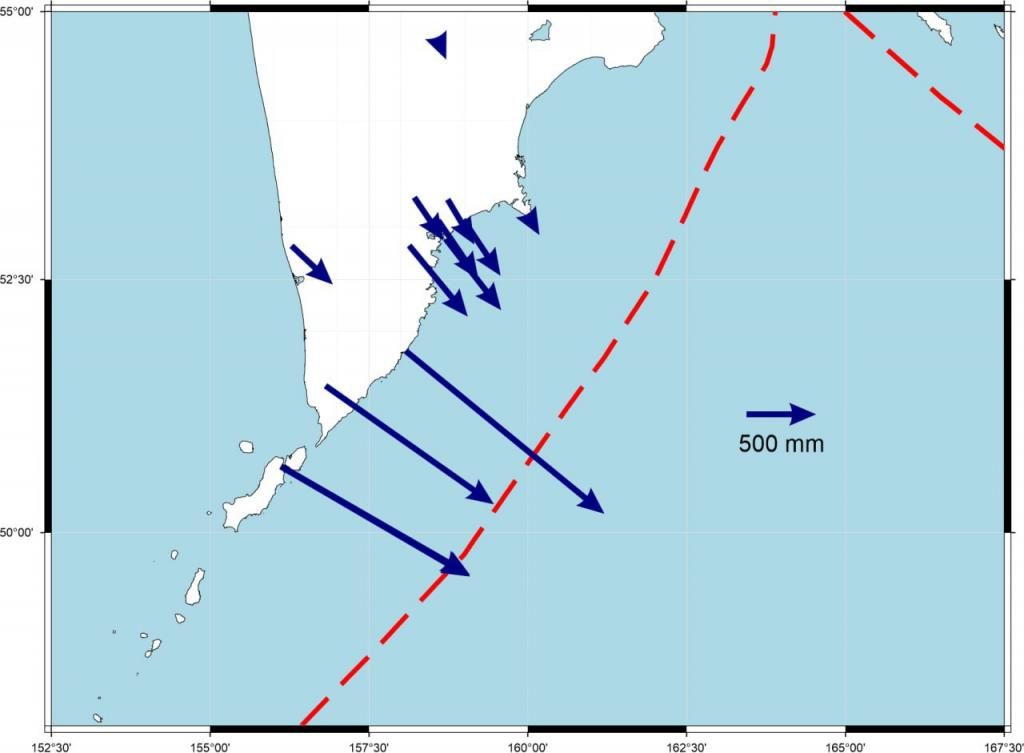
On August 5, the Kamchatka Branch of the Geophysical Research Institute under the Russian Academy of Sciences reported that the powerful earthquake that struck off the coast of the Kamchatka Peninsula on July 30 caused a dramatic shift of nearly 2 meters to the southeast in the southern region of the peninsula. This scale of displacement is comparable to the land shift observed during the 2011 Great East Japan Earthquake.
Initially estimated at magnitude 8.5, the earthquake was later revised to 8.7, making it the most powerful quake recorded in the region since 1952. The Unified Geophysical Service of the Russian Academy of Sciences confirmed via social media that this is the strongest seismic event in over 70 years for the area.
Though the epicenter was offshore, the seismic energy caused significant crustal displacement on land. Using satellite remote sensing and GNSS (Global Navigation Satellite System) data, researchers mapped the surface deformation in detail, confirming a southeastward shift consistent with the direction of tectonic subduction.
🔬【Seismological Perspective】
From a geological standpoint, the Kamchatka Peninsula lies along the convergent boundary between the Pacific and North American plates, one of the most active subduction zones in the world. This event qualifies as a megathrust earthquake, characterized by a shallow focus and broad rupture zone, capable of triggering massive land movement and potential tsunamis.
Experts warn that such a sudden crustal shift can disrupt the regional tectonic stress balance, increasing the risk of aftershocks and secondary geological hazards in the coming months. Scientifically, this seismic activity provides valuable data for understanding tectonic behavior and refining energy release models in complex subduction zones.